Teaser; upcoming post
The most famous volcano in Chile is Volcan Villarrica, it is also the most active volcano, with a plume coming up from the crater, pretty much constantly. We first saw this one from the plane, and instantly decided that we needed to come by here and try to summit it, like the other 50-60 000 summiting each year (according to our guide; Lonely Planet). So, done with the Carretera Austral, we headed a bit eastwards from route 5, into Pucon. We had read that the climb up to the summit would be on snow, so we were kind of surprised to see how small the ice field was (a very warm summer?) and started dreading walking on scree and loose gravel, instead of compacted snow and ice (which should be relatively more easy).
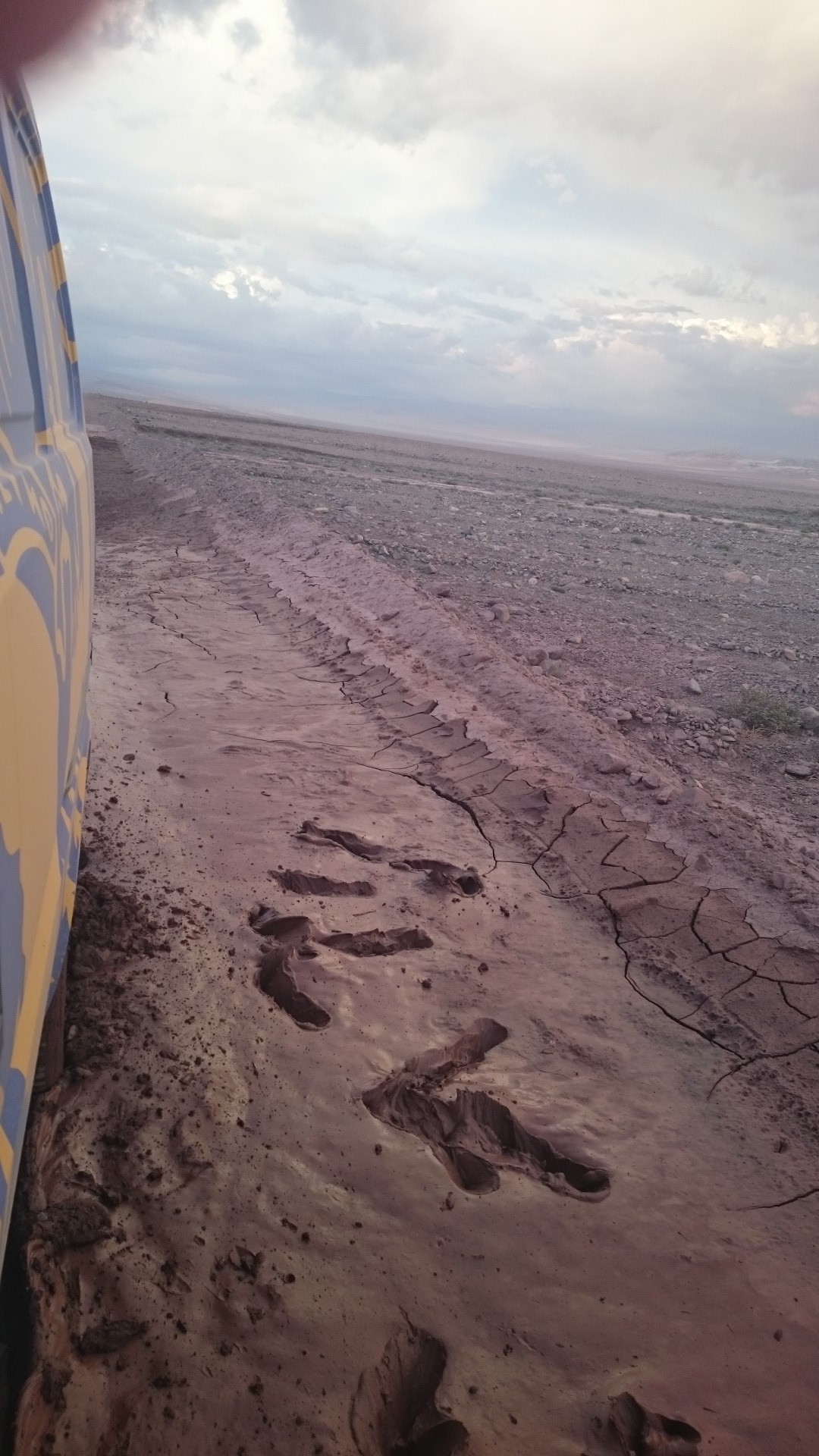
Turns out, Volcan Villarrica was a bit too active; just 10 days earlier there was a major eruption, effectively shutting down all activity at least until winter. And what we interpreted as “little snow”, was in fact ashes and tephra streams covering almost the entire volcano. So, definitely a disappointment, but decidedly a very spectacular one; it’s not often we have been thwarted by a volcano eruption, usually it’s something much more pedestrian, like forest fires or flashfloods in the desert (in Death Valley, an oxymoron for sure).

So, we returned to route 5, northbound. We are now headed for the more populated, and frankly, less interesting part of Chile. Oh, it’s still a nice view, with vineyards and the odd laguna here and there, but mostly it’s small towns and the four-lane high way. Poor Ramone gets uncomfortable with speeds exceeding 100 kmph, but that’s ok, since its already quite precarious holding my camera out the window trying to “capture the atmosphere” without the wind snatching it out of my hand.
Although Chile has some very old cities and settlements, we haven’t felt inspired to make any stops at the larger cities along the way. Architecture-wise, it seems fairly rundown, even if they paint the, for lack of a better word, shacks, in the color palette of “My little pony”. Eventually route 5 left the flat inlands (which were also too warm for my liking; I don’t do well with temperatures over 22 C) and veered off to the coast. Now we’re talking! Beaches, cliffs, volcanic rock, martian like landscapes (well, sans the fierce Pacific Ocean of course).
We did stop at Valparaiso, just for a quick soaking of the atmosphere, and a trip with the ancient ascensor (1890-ish). Well, strictly speaking, after asking google about parking in Valparaiso, we ended up at the municipal, staffed, parking next to the Vina del Mar metro stop. We felt pretty safe with leaving our car there, and the some 15 minutes with the metro was really very scenic, with the tracks hugging the coastline, with a plentitude of beaches and rustic piers. And we agree, Valparaiso was definitely worth a visit, with it’s steep hills, stairways, ascensors, and the colors! The city is apparently infested with art students, who have made it a mission of leaving no wall unpainted. I’m pretty sure we only saw a tiny, tiny fraction, but what we saw, we liked.
But, urbanites, we are not. So, back to Ramone again, and route 5. we had been looking forward to arriving at the coast, with the idea that there would be ample opportunities of camping along beaches. We were not mistaken. One spot is nicer than the next, and it’s only the arriving dusk and nightfall that forces us to finally make a choice and park.
Finally back to civilization, aka cellular signal! And ATM’s that are willing to give us cash!
After a night in the Argentinian pampas (if you’ve seen one, you’ve probably been seeing it for some stretch of time), we now crossed back into Chile at the sleepy town of Chile Chico. There’s not much to do here, besides stocking up at the supermarket and getting more fuel. We had two options onwards; we could either take the scenic route, around the Lago General Carrera, and about 300 km of gravel roads, or take the 2 hour ferry straight across the lake to Puerto Ibanez… We’ve never quite appreciated asphalted roads before this trip, and the choice was made easier by the low cloud cover and rain; so we got up at first crack of dawn and sat hopefully outside the ticket office, waiting for it to open. There are no information in english, and while the google translator app has been a savior a few times, it can also dish out some pretty interesting interpretations. It turns out, taking a ferry in Chile is pretty much the same as in Norway; first come, first serve (except for those who’ve booked tickets online).
Now we’ve definitely come into some different climate. It’s been pouring down the last few days, since crossing Lago General Carrera, and poor Ramones windscreen has developed a leak (though nothing some duct tape wouldn’t fix).
Coyhaique was a bit of a shock; much busier than we anticipated, and not a very pleasant place to stay, in our opinion. We loaded up on vegetables that was confiscated at the border, bought gas and left, as soon as possible. This part of Chile looks to be a pure road trip. There aren’t too much to do here, maybe fishing for those so inclined. It rained a whole lot, with only a few pauses with sunshine. We also had the pleasure of waiting 4 hours at a stretch of road with construction (closed between 1300 and 1700 due to dynamiting). If only we hadn’t been so slow to get up in the morning…
We didn’t get many kilometers today because of the delay, and stopped early in the small town of something nearly unpronouncable; Puyuhuapi, at a not super nice campground, but with good company (and I don’t mean Lars ;) and the prospect of a hot shower tomorrow.
Leaving the Torres del Paine national park behind, we steered Ramone towards the Argentinian border. After many kilometers of ripio, unpaved, dirt roads (The spanish word for gravel roads is ripio, which i find to be a very fitting word as the stones and washboards try to rip poor Ramone apart), we ended up at Cerro Castillo, where we almost forgot to stop and get our stamps at the border control (the gate was just wide open, you know?). Not much english spoken here, as usual, but we managed to get our passports stamped by one guy, and Ramones papers stamped by the other, and off we went. In like, 30 kmphs, due to lack of asphalt.
We hadn’t realized beforehand, only because we didn’t look very closely on the map, how much of Patagonia was actually in Argentina, and so we now had a distinct lack of travel-mojo for the next stretch, to El Calafate and El Chalten, primarily. Mostly money wise; Visa is not that common (luckily, we have MasterCard as well, though Lars has forgotten his PIN, of course); roaming apparently doesn’t exist, not even for our Norwegian mobile provider; the most prevalent ATM wont give us money; and the exchange rate to Argentinian pesos is horrible, except if you bring USD or EUROs, cash, and make exchanges on the black market.
But this we found out after the very first blunder; namely choosing the shortest way from Cerro Castillo to El Calafate, along Ruta 40 ( which i guess is Argentina’s route 66 or something, except with a lot less services along the way). We knew there would be plenty of buses carrying tourists to El Chalten, and seeing none of these along the way, it got pretty obvious that we had picked the “scenic route”… In hindsight i asked the GPS for an alternate route, and sure enough; there was one of twice the distance, but still with less time than the one we chose. The upside was a pretty damn quiet camp spot along the way!
The main high light of El Calafate, and possibly the only one, is the Perito Moreno Glaciar. This one was a must see for me. It is quite spectacular and incredibly active, and although we weren’t fortunate enough to see a big calving, ice the size of large boulders was constantly falling off, hitting the water with a loud gunshot like noise. The front of the glacier is some 4 km in width, 50-60 m above the water line, and 14 kilometers deep. And this is just one tiny arm of the ginormous Campo de Hielo Sur, the southern Patagonian ice field. It completely boggles the mind!
As an aside note, we asked a park ranger to pretty please, let us camp in the parking lot over night, but I think those days of leniency are long gone. We were politely directed to a free camp site, at Estancia Rio Mitre, which of course, isn’t free anymore. Though, at 60 pesos per person, it was the cheapest, and much, much nicer than the ones in town (and also preferable to the night before where we learned a new spanish phrase: “no puede campara aqa”, with “aqa” being an informal, friendly “aqui”). With a baby llama guarding the door. To pass, you had to pay the toll of cuddles, Lars of course was happy to oblige.
Then, onwards to El Chalten. This is the main spot in Argentina for hiking, but being march and the shoulder season, the town was pretty quiet. Or it may have been the Patagonian wind, with some rain added for variation, chasing people inside.
We had some okay weather, but with a low cloud cover, so we didn’t really see neither the Fitz Roy, nor Cerro Torre. We got to see a few glaciers though, again these are arms of the Campo de Hielo Sur. There is no free camping inside the park, but we found a charming campsite just a few kilometres past El Chalten heading towards the Laguna del Desierto. 60 pesos per person, and hot showers. Also, with two sheep who thought they were dogs. Also, we learned that Ramone will completely drain his battery if we forget to turn of the headlights before going hiking.
Time to get back to Chile, and cellular signal, or even just usable wifi. Again, some 80 km of ripio, but then all asphalt, all the way to the Chilean border town, Chile Chico!
We didn’t spend more time than necessary in Punta Arenas, and hit the road asap after collecting the camper van. Or Ramone, to use it’s short hand name (the name should be self evident from the pictures). Personally I have no idea who The Ramones were, but we’ve had a fan take a selfie with Ramone, so I guess we could have worse luck as to the décor. But it’s hardly a speed machine, and doing more than 90 kmph is quite… loud. Not the engine of course, more from the wind noise as the car is hammering itself through the patagonian wind.
The wind! Constant. Unrelenting. Wind!
Everyone who’s been to Patagonia says something along the lines of; o-ehm-gee, so beautiful, amazing, nature, llamas, mountains, glaciers, steppes, rain, sun, rain and sun, and _wind_. They are… not wrong. Already in Punta Arenas we could start to get a feel for the ever-present wind, and we quickly learned how important it is to park Ramone nose first into it. And that’s the weird thing about the patagonian wind; it’s always just the one direction, mostly west to east, although you can have local variations depending on the terrain. Apparently the wind is a pure summer phenomenon, and in the winter there is hardly any (according to a seemingly knowledgeable local person).
Anyway, heading out of town, due north. We decided to skip Terra del Fuego, and spend the some 24 hours of driving to/from Ushuaia saved, in the mountains instead. After only a few hours of driving on Ruta 9, due to a late start (lost quite some time hunting down gas canisters for our kitchen stove), we found a nice side road next to a river to park for the night. Lots of anticipation for our first night in Ramone, rough camping it in the Chilean middle-of-nearly-nowhere. And it was awesome! Super comfortable beds, though some refining the technique of the getting in and out of the side door while putting on/taking off shoes and not dropping them is needed.
The next morning we arrived in Puerto Natales. By a real stroke of luck we managed to get on a kayak excursion the morning after, arranged by Hello Kayak. Not a cheap option, but very professional with great personal equipment (semi-dry suits) and the guides were real kayak-bums (maybe I invented this term) and very skilled. The kayaks were the double kind, which can be a challenge for people with different paddling timing, but after some initial cursing and dousing of river water, Lars and I managed to paddle sort of in sync. But not much paddling was needed, where we flowed with the down stream of River Gray, with the quite stately Torres del Paine at our backs, and the absolutely magnificent ice range in the west (I instantly forgot the name after asking, but something with O’Higgins). After some hours of paddling, we drove to a nearby camp ground (Luis the minibus driver was kind enough to slow down enough for Ramone to catch up), where the kayak bums served up delicious salmon and beef for dinner, and we had Australian and north-American help in finishing our boxed wine and Cerveza Austral. They were amazing company and it took an embarrassingly short amount of time before the conversational topic deteriorated into bodily functions and the like… always a sign of quality company!
Waking up with a slight red wine hang over, we took farewell with the rest of the guys who were paddling on for the next stretch, while Ramone and us headed to the main attraction of the park; the Torres del Paine. Pavement has yet to come to the park, and it was a fairly bumpy ride (although, this is just the beginning of the bad roads ahead).
We decided to only walk the day hike to the Torres (towers). Just under 3 hours up, with sun and summer-temperatures, to be rewarded with dipping warm feet into the ice cold laguna underneath the Towers. When sitting by the laguna and looking up, it’s quite mind boggling when you realize the summit is 2000 meters above where you are sitting — the scale of the place is so unfamiliar that I would probably put the summit at just about 500 meters up; this is the sort of stuff I’m “used to” seeing from back home. Properly impressed, we rushed back down to cook some pasta bolognese-ish dinner, and found a super nice camp spot right outside the national park gates, with a sweet view of the towers in the sunset.
Crossing the Atlantic ocean was completely uneventful, thankfully, albeit looong and boring. I tried to count the hours of flight from Schiphol (did I spell that right?) to Buenos Aires, but my mind boggled and refused to add such high numbers (after watching 2 movies, one of which was a costume drama I was sure would put me to sleep, of course it didn’t), there was still 8.5 hours left of flying).
Anyways, we arrived in Santiago with all our luggage, sleep deprived and in shock by the change in temperature and humidity, coming from winter back home. To put this in perspective; Lars even agreed to pay for early check in at our air conditioned hotel (the airport hotel, splurge on day one!)
The next leg of our journey was flying from Santiago to Punta Arenas, the second most southern city in the world (actually, I don’t know this). In Punta Arenas we will pick up our Wicked camper van, which will be our home and transport for the next 40 days. Wee!
